01 Assessment of economic value of the Oji Forests (550 billion yen/year)
Economic value of the Oji Forests (in Japan): 550 billion yen/year
We have been engaged in forest development within the Oji Group's forests in Japan since the 1930s. Forests have multiple functions, for example, they absorb and store carbon dioxide (CO2), conserve biodiversity, cultivate water sources, and prevent landslides. And of course, there is the sustainable cycle of forest plantation, cultivation, felling and then plantation again.
We have estimated the economic value of these public benefit functions of our forests using an assessment method from the Forestry Agency,*1 and other methods, and found that their economic value is approx. 550 billion yen per year.
We will continue to collaborate with academia and a startup to consider how we reflect regional characteristics in these evaluations, improve their precision, add value from a new perspective and implement other initiatives with a view toward the future introduction of natural capital accounting.
*Calculated using the method described in the Forestry Agency of Japan's Shinrin-no Koueki-teki Kino-no Hyokagaku-ni Tsuite (valuation of forests' public benefit functions) (2000)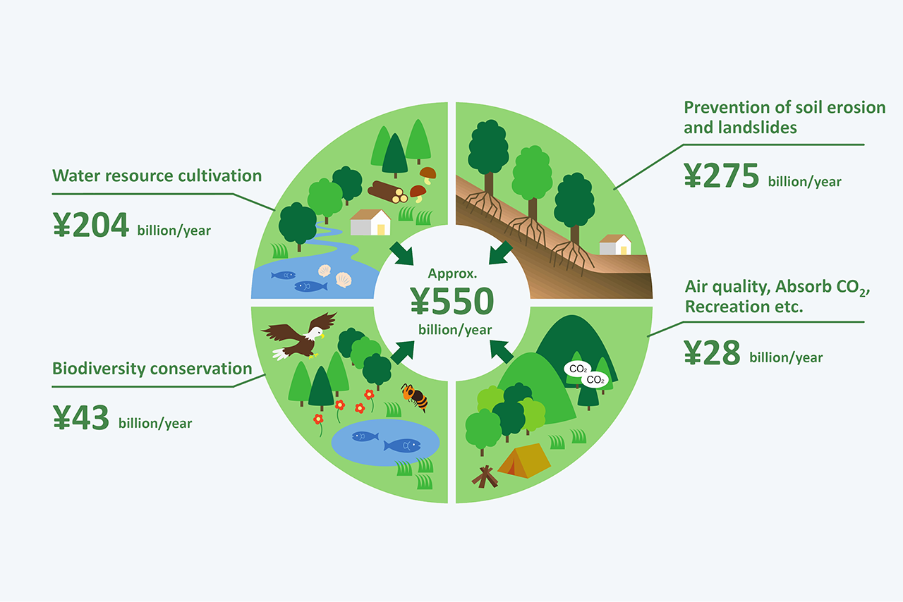
02 Collaborations with academia and a startup
Dedicated to the maximization of the value of forests
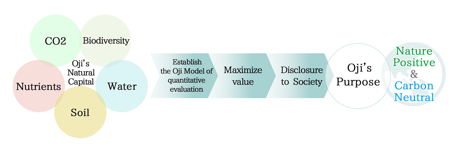
We plan to select multiple important mountain forests from among the Oji Forests and press ahead with the visualization (quantitative evaluation) of the diverse functions of forests by collaborating with a startup and academia.
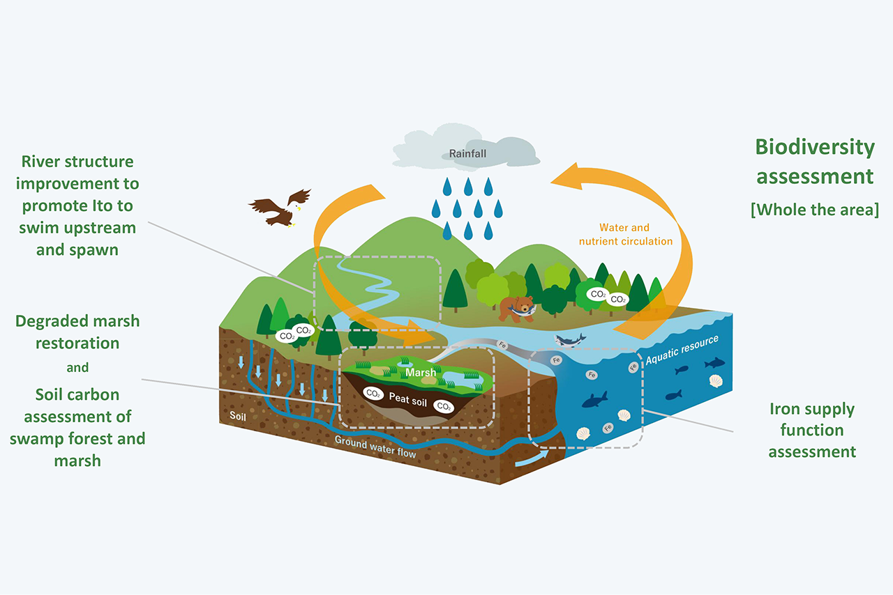
We will visualize the value of five key elements of nature (biodiversity, CO2, nutrients, soil and water) before acting to improve and maximize their value through nature restoration and disclosing information.
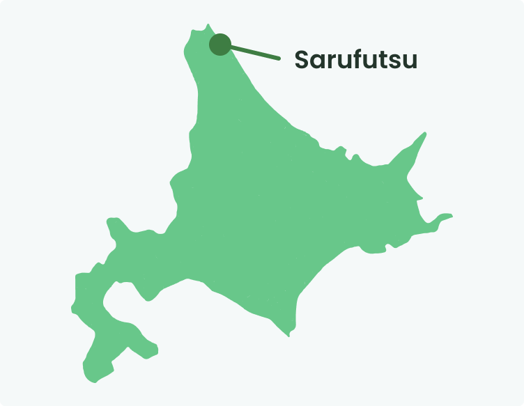
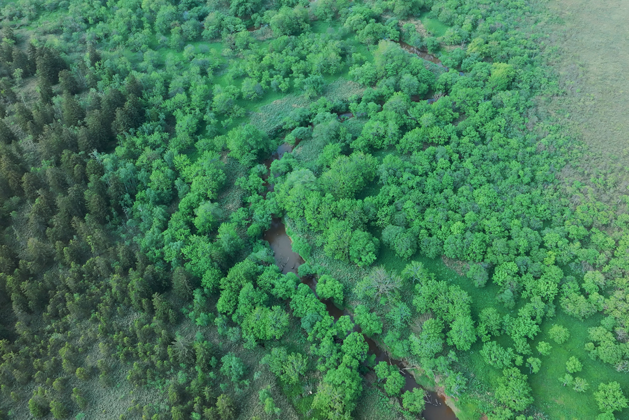
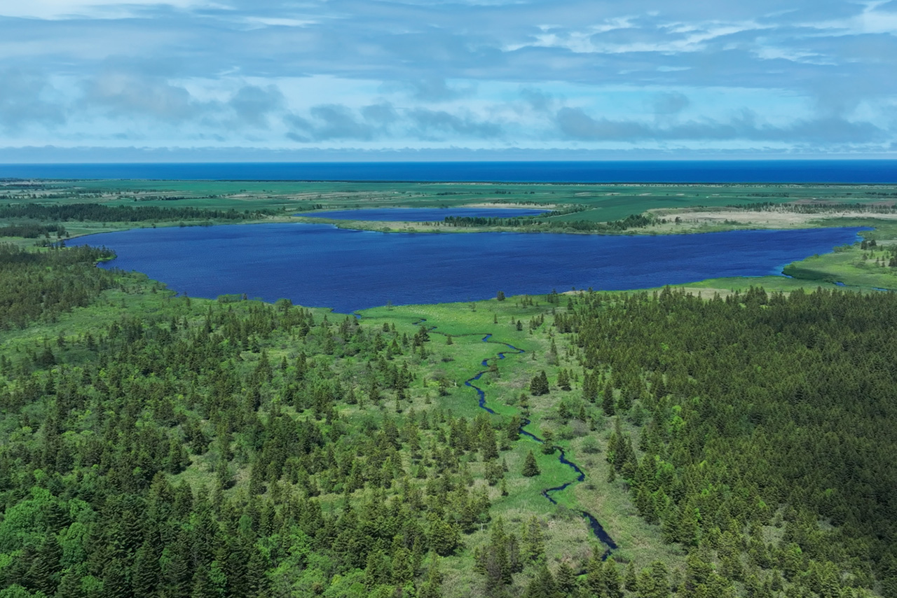
Initiatives taken at the Sarufutsu Forest (collaboration with Hokkaido University)
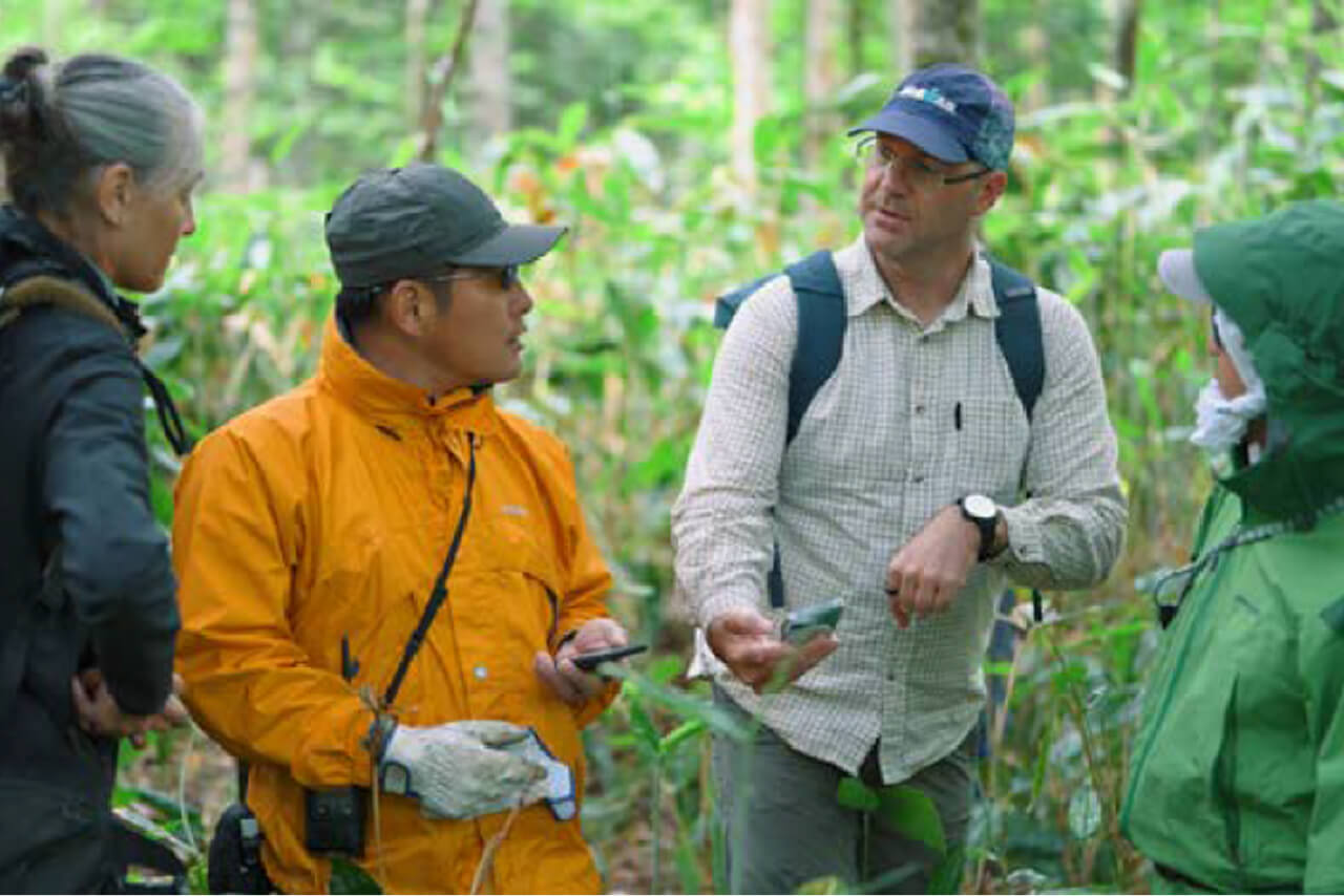
We have begun to act jointly with researchers from Hokkaido University in the Sarufutsu Forest in Hokkaido, which is believed to be one of the most important of Oji Forests in terms of biodiversity.
Specifically, we plan to learn about the current status of the river and marshland and the link between the forest and ocean and implement initiatives including protection of the itou, which is the largest freshwater fish in Japan and an endangered species, and to restore valuable marshland.
Through these initiatives, we will consider how to balance and maximize the various types of value obtained from not only wood, which has already been our focus, but also forest management.
Actions taken at the Sarufutsu Forest (collaboration with a startup)
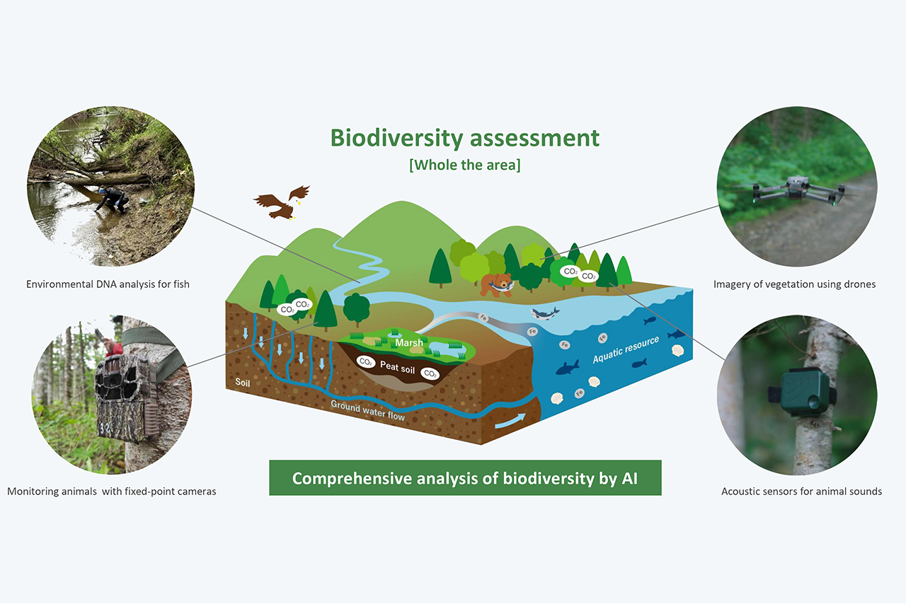
We are working to assess the biodiversity of the forest jointly with an overseas startup that is working to develop biodiversity assessment technologies in anticipation of the development of international systems.
Specifically, we use AI to analyze data about various animals and plants that we obtained using a combination of multiple cutting-edge field-monitoring technologies, including drones, cameras, acoustic sensors and environmental DNA. We have thus been working to comprehensively assess biodiversity in a way that adheres to common global standards.
Balancing forestry and biodiversity conservation in the Sarufutsu Fores
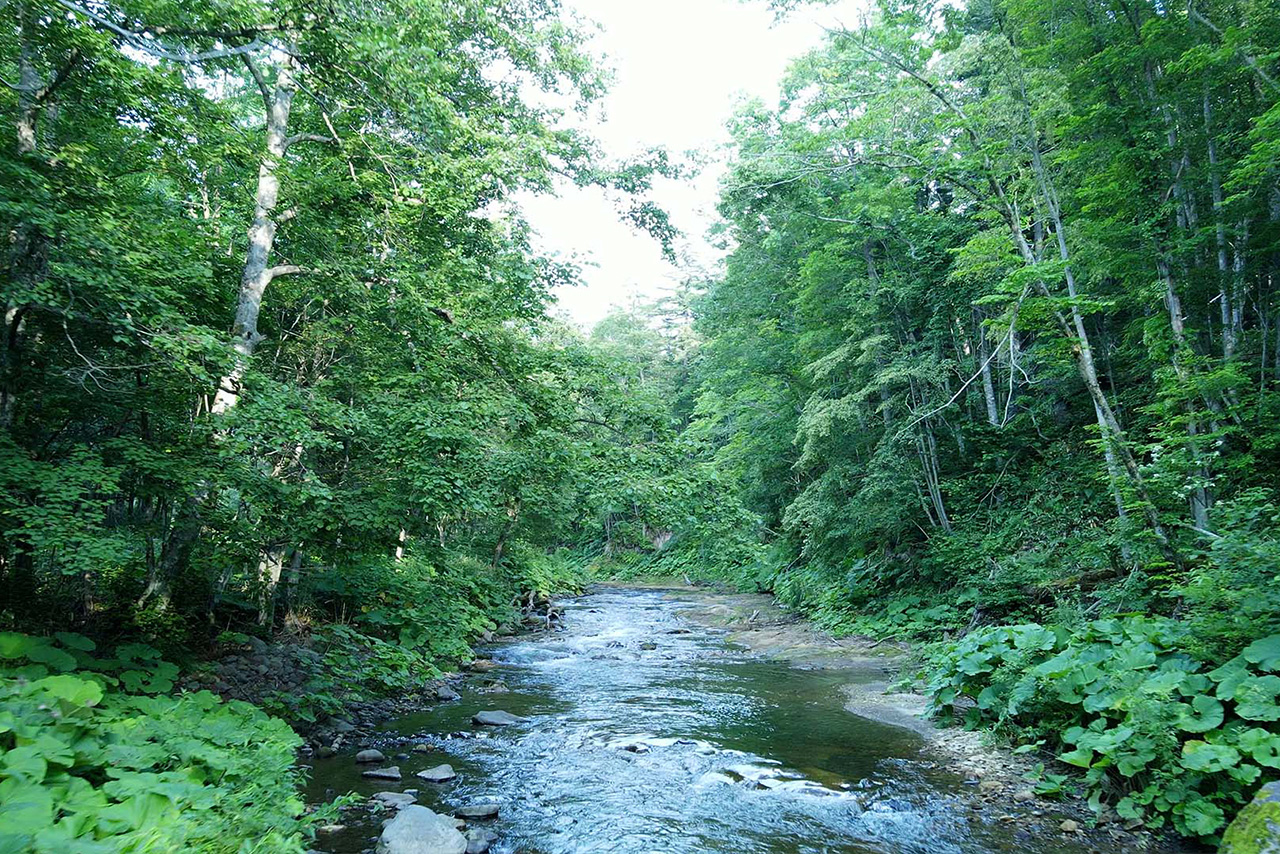
The biodiversity of the Sarufutsu Forest is unique, with its mix of forests, marshes and mountain streams. It includes softwood such as Akaezomatsu (Pecea Glehnii) trees that are more than 100 years old and hardwood including Japanese oak. It is believed that marshland is not only a valuable habitat for many species but also supplies nutrients to coastal ecosystems and stores vast amount of carbon in the peat soil underneath the surface of the land.
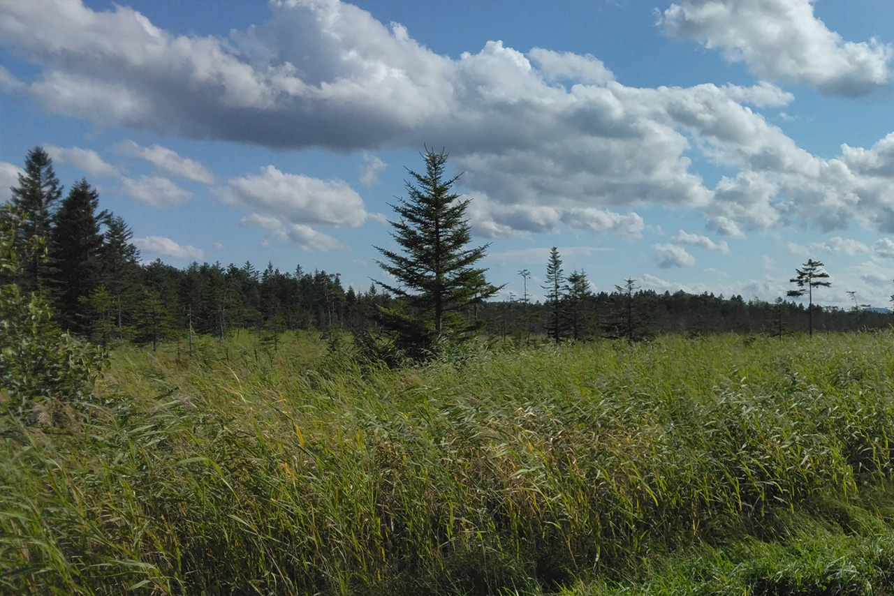
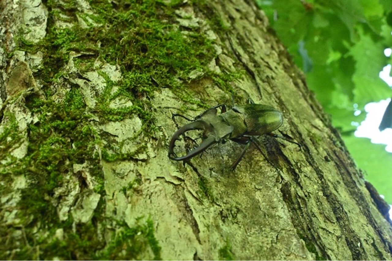
In this place, we have been dedicated to balancing forestry activities and the conservation of biodiversity. One initiative representative of these efforts is our protection of the itou, a rare species of fish whose habitat is the river in the forest. For example, we consider itou spawning beds when felling trees, avoiding felling on sloped ground to prevent sediment runoff and avoid felling within a certain distance of mountain streams. We are dedicated to maintaining the unique biodiversity of the Sarufutsu Forest for the next 100 years through proper forest management.
Future initiatives
While in recent years companies have been required to disclose nature-related information, the standards for assessing nature and the methods for visualizing it have yet to be established, even in academia.
As a first step, we are moving forward with the visualization of the value of nature. In the future, we would like to establish an Oji Model method for assessing the value of nature and connect it to natural capital accounting, which measures the value of nature in terms of economic value so that this information can be disclosed. We will remain committed to visualizing and maximizing the value of forests.
03 Forests that enrich biodiversity
Visualizing forests' functions to conserve biodiversity
Forests are habitats and nursery ground of many species of wild animals and plants. Forests' function of protecting genetic resources, species, and ecosystems is called the biodiversity conservation function. In this section, we introduce our initiatives for visualizing (quantitatively evaluating) the biodiversity conservation function of forests.
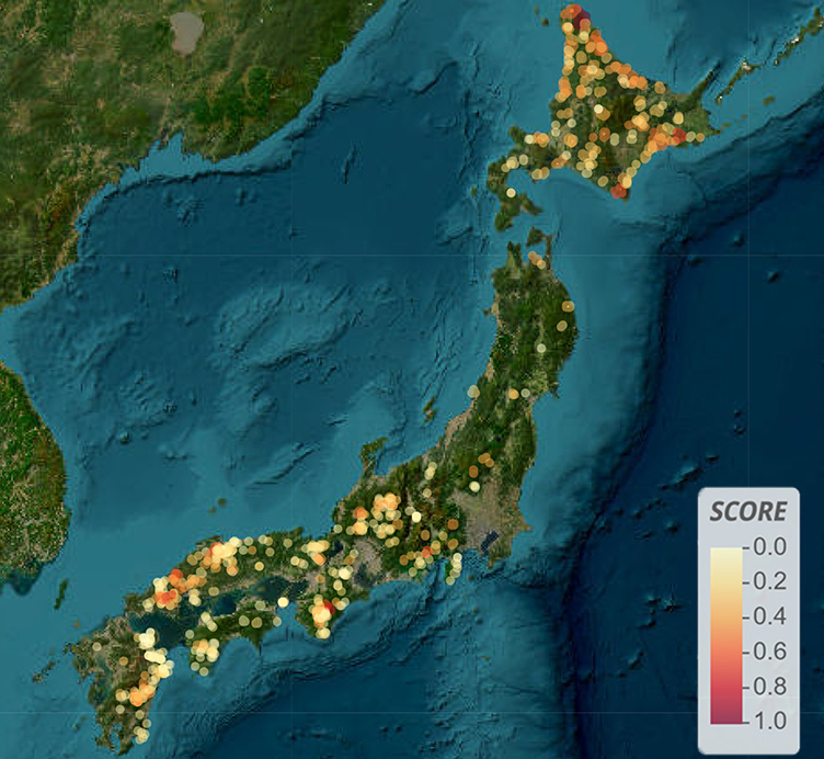
We assessed the importance of 650 Oji Forests in Japan in terms of biodiversity. The results are as shown on the map. The closer to 1.0 (red) the score is, the more important the forest is for biodiversity.
The assessment was conducted examining the overlap with key biodiversity areas for conservation (KBAs),*1 the number of types of vegetation obtained from Ministry of the Environment vegetation data, the biota estimated using a species distribution model,*2 and the coverage rate of rare species in each area.
- *1 KBAs are areas of key importance for the conservation of biodiversity
- *2 The species distribution model is a method of estimating the distribution of species across a geographic area based on environmental conditions which impact the distribution of species (including climate, vegetation and terrain)
More than 3,000 species living in Oji Forests
Further, using the above species distribution model, we estimated the species of living organisms whose habitats are Oji Forests. The results indicated an estimated total of more than 3,000 species, including approx. 1,400 rare species,*3 live in the forests.
It is likely that our many years of forest development efforts have helped maintain the ecosystems of each area.
- *3 Rare species are Type I (I-shu) endangered species in category II (II-rui) (most endangered species) from the prefectural red data books
| Taxon | Estimated number of species | Of which, rare species |
|---|---|---|
| Amphibians | 51 | 25 |
| Birds | 294 | 97 |
| Seed plants | 2,667 | 1,273 |
| Total | 3,012 | 1,395 |
04 Forests that enrich water resources
Visualization of forests' water resource cultivation function
Forest soil has a sponge-like structure. It is formed when leaf soil, which is made mainly from fallen leaves, has been decomposed by worms or microorganisms. Due to this structure, forest soil retains water and slowly releases clean water. This is called the water resource cultivation function. In this section, we examine our initiatives to visualize (quantitatively evaluate) this water resource cultivation function.
Oji Forests create water for 16.9 million people
We calculated the amount of water resources that the 650 Oji Forests in Japan cultivate per day (the amount of rainwater that penetrates the soil from the surface)*1 to be approx. 5.1 million m3/day. This is equivalent to the water consumed by approx. 16.9 million people per day.*2
In addition, we compared the economic value of this to the cost of the infrastructure that would otherwise be needed, such as water-supply dams and flood-control dams, and found that the value of the forests in this regard is approx. 204 billion yen/year.
In light of the above, we believe that Oji Forests have a significant economic impact through their prevention of landslides due to rain, retention of water, and slow supply of clean water.
- *1 Calculated using the National Land Information Platform
- *2 Calculated assuming one person at home uses 300 liters of water per day.
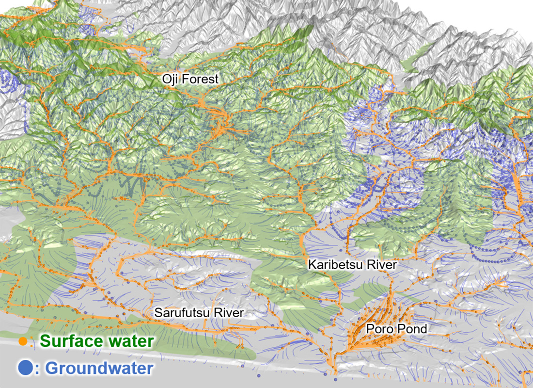
Surface water flowing from the summit to the base of the forest refers to rain running off on the land surface or water flowing above ground like rivers.
Groundwater refers to rainwater that infiltrates the ground and flows underground.
The map shows that Oji’s Forest stores a large amount of groundwater and plays an important role in water resource conservation.